AREA 25 - BEAR RIVER/CACHE VALLEYUpdated:ĀApril 10, 2011 |
|
|
MANAGEMENT The area was first adjudicated, and a Proposed Determination of Water Rights was published in 1949; an Interlocutory Order was issued in 1953. A Proposed Determination of Water Rights, involving seven books, was published in 1965 and 1966. A Bear River System Decree was issued in 1969. A number of decrees have been issued on the Little Bear River in 1909, 1922, 1931, 1941, 1946, and 1961. The area is part of the Bear River Distribution System, which is administered by the Bear River Commissioner. It also includes the Little Bear River Distribution System and the Logan River Distribution System, which are administered by the Little Bear River Commissioner and the Logan River Commissioner, respectively. Because this area is part of the Bear River basin, the conditions of the 1955 Bear River Compact apply. Click here to see statistics for this area. SOURCES Surface and Ground Water - The area is open to appropriation of both surface and ground water, except in certain areas described hereafter. Applications for more than 1.0 cubic feet per second of flow require a signed compensation agreement with Pacificorp as a condition of approval. Those filing an Application to Appropriate in Cache County are required to file a disclaimer form indicating their compliance of items 1 and 8 of the Interim Cache Valley Ground-water Management Plan. No filings are approved in canyon areas above fully appropriated springs and streams. The area east of Richmond is closed to new appropriations. The Clarkston Creek drainage above Newton Dam and the Cove area are generally restricted to small applications, which are limited to the domestic use of one family, the irrigation of 1/4 acre, and a nominal amount of livestock watering. Changes from surface to underground sources, and vice versa, are also considered on their individual merits, with emphasis on their potential to interfere with existing rights and to ensure that there is no enlargement of the underlying rights. Fixed-time and temporary projects, especially those involving surface waters, are evaluated in a similar fashion. GROUNDWATER MANAGEMENT PLAN In 1999, the State Engineer issued his Interim Cache Valley Ground-water Management Plan which gives the conditions and limits under which further ground-water development may take place. The primary objective is to protect prior water rights while putting to beneficial use the greatest amount of available water.GENERAL Applications are advertised in the Logan Herald Journal. Filings that may involve the diversion of water in Utah for use in Idaho (export) would be subject to the special criteria the statutes require for such projects. The general irrigation diversion duty for this area, which the State Engineer uses for evaluation purposes, is 3.0 acre-feet per acre per year (af/ac) in the Little Bear and Blacksmith Fork drainages, and 4.0 af/ac in the remainder of the area. The consumptive use requirement is determined from the publication Consumptive Use of Irrigated Crops in Utah, Research Report 145, Utah State University, 1994, unless the applicant submits other data for consideration. This area is administered by the Northern Regional Office in Logan. Other requirements The Water Right applicant is strongly cautioned that other permits may be required before any physical development of a project can begin and it is the responsibility of the applicant to determine the applicability of and acquisition of such permits. In order to avoid delays and ensure that Water Right approvals conform to applicable local ordinances, applicants should contact local governmental entities in advance to determine what ordinances are in place that affect the proposed project and to make sure that Water Right filings conform to those ordinances. The approval of a Water Right application does not imply any approval of a project by any other governmental entity. Approval of the project proposed in the Water Right application should be obtained from local governmental entities as necessary to implement a project. REFERENCES Technical Publication No. 36, Ground-water resources of Cache Valley, Utah and Idaho; Utah Department of Natural Resources; 1971. Technical Publication No. 105, Seepage Study of the Bear River including Cutler Reservoir in Cache Valley, Utah and Idaho; Utah Department of Natural Resources; 1992. Technical Publication No. 108, Hydrology of Cache Valley, Cache County, Utah, and adjacent part of Idaho, with emphasis on simulation of ground-water flow; Utah Department of Natural Resources; 1994. Basic-Data Report No. 18, Quality of Surface Water in the Bear River Basin, Utah, Wyoming, and Idaho; Utah Department of Natural Resources; 1970. Basic-Data Report No. 21, Selected Hydrologic Data, Cache Valley, Utah and Idaho; Utah Department of Natural Resources; 1970. Information Bulletin No. 19, Ground-water Hydrology of Southern Cache Valley, Utah; Utah Department of Natural Resources; 1967. MODELING Regional Ground-Water Flow, Carbonate Rock Province, Nevada, Utah, and Adjacent States; USGS Open-File Reports 93-170 and 93-420; 1993. PREVIOUS PAGE UPDATES |
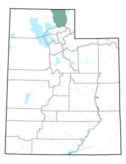
Policy area in green,
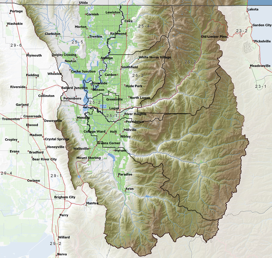
click on the map for more detail DESCRIPTION Covering all of Cache County from T8N to T15N, this area includes the main stem of the Bear River and a number of its major tributaries, including the Little Bear, Logan, and Cub Rivers. It is bordered on the north by Idaho, on the east and southeast by the Bear River Range, on the west by Clarkston Mountain, and on the southwest by the Wellsville Mountains. Large federal storage facilities, at Hyrum and Newton Dams, and smaller privately owned reservoirs store spring runoff to supplement late season irrigation diversions. Cutler Dam, at the valley's natural outlet, serves as a hydroelectric generating facility for Pacificorp and the diversion point for two major canals serving lower water users in the Bear River basin. The highest point in the area is 9,980 foot Naomi Peak, while the lowest is the surface of Cutler Reservoir at about 4,410 feet, giving a total relief of about 5,570 feet. |
|
|
|