Viewing the Water Right Network
Network Products:
Water Right Network data can be viewed and/or downloaded from the following sources:
- Water Rights Map Server
- ArcGIS Rest API - Please reach out for assistance if you are interested in using the network.
- Utah State Geographic Information Data source (SGID)
Basic Network Elements:
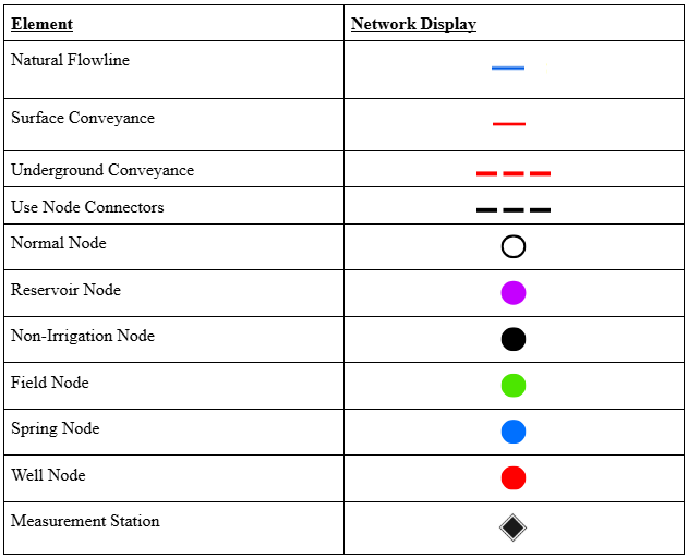
The network generally consists of standard components with colors and styles that correspond to their properties, function, or use. Below is a table of elements and their corresponding network display. These elements are also viewable under the legends on the associated 'WRN Depletion Areas' and 'WRN Flowlines & Nodes' layers.
The Three Main Elements of the Network are:
- Depletion Areas: These polygons reflect an area irrigated by a conveyance path and can overlap.
- Flowlines: These show natural flow paths such as rivers and streams. It also shows surface and underground conveyances.
- Nodes: These are the joints between the Water Right Network Elements.
Network Database Tables metadata and field descriptions.