AREA 16 - SOUTHERN GREAT SALT LAKE DESERT, SKULL VALLEY, and DUGWAY VALLEYUpdated:ĀNovember 3, 2022Recent changes and additions in red text |
|
|
MANAGEMENT No Proposed Determination of Water Rights books have been published for this area. There are no state-administered distribution systems in this area. Click here to see statistics for this area. SOURCES Surface Water - Surface waters are open to appropriation if unappropriated sources with adequate supply and quality can be found. Most known sources of useable size have been appropriated. Ground Water - Ground water is open to appropriation. New filings are reviewed on their individual merits with emphasis on the potential for interference with existing rights. Suitable quality may be a problem in some areas. Governor's Proclamation 2022-01 - On November 3, 2022, Governor Spencer Cox issued a proclamationĀsuspending new appropriations of surplus and unappropriated waters in the Great Salt Lake Basin pursuant to Utah Code 73-6-1. To read the press release from the Governor's office, click here. To read the proclamation, click here. A report on the proclamation to suspend appropriations in Great Salt Lake Basin was published on November 22, 2023 and can be read here. To view a map of areas subject to the proclamation, click here.The following are excepted from the effect of this proclamation:
GENERAL Applications are advertised in the Tooele Transcript or the Nephi Times-News. Filings that may involve the diversion of water in Utah for use in Nevada (export) would be subject to the special criteria the statutes require for such projects. The general irrigation diversion duty for this area, which the State Engineer uses for evaluation purposes, is 4.0 acre-feet per acre per year. The consumptive use requirement is determined from the publication Consumptive Use of Irrigated Crops in Utah, Research Report 145, Utah State University, 1994, unless the applicant submits other data for consideration. This area is administered by the Weber River Regional Office in Salt Lake City. Other requirements The Water Right applicant is strongly cautioned that other permits may be required before any physical development of a project can begin and it is the responsibility of the applicant to determine the applicability of and acquisition of such permits. In order to avoid delays and ensure that Water Right approvals conform to applicable local ordinances, applicants should contact local governmental entities in advance to determine what ordinances are in place that affect the proposed project and to make sure that Water Right filings conform to those ordinances. The approval of a Water Right application does not imply any approval of a project by any other governmental entity. Approval of the project proposed in the Water Right application should be obtained from local governmental entities as necessary to implement a project. REFERENCES Technical Publication No. 18, Hydrologic Reconnaissance of Skull Valley, Tooele County, Utah; Utah Department of Natural Resources;1968. Technical Publication No. 26, Hydrologic Reconnaissance of the Sink Valley Area, Tooele and Box Elder Counties, Utah; Utah Department of Natural Resources; 1970. Technical Publication No. 59, Hydrologic Reconnaissance of the Dugway Valley-Government Creek Area, West-Central Utah; Utah Department of Natural Resources; 1978. Technical Publication No. 71, Hydrologic Reconnaissance of the Southern Great Salt Lake Desert and a Summary of the Hydrology of West-Central Utah; Utah Department of Natural Resources; 1981. Basic Data Report No. 43, Selected Test-Well Data from the MX-Missile Siting Study, Tooele, Juab, Millard, Beaver, and Iron Counties, Utah; Utah Department of Natural Resources; 1985. Water-Resources
Investigative Report 95-4173, Simulated Effects of Proposed Ground-Water
Pumping in 17 Basins in East-Central and Southern Nevada; USGS Scientific Investigations Report 2014-5213, Steady-State Numerical Groundwater Flow Model of the Great Basin Carbonate and Alluvial Aquifer System; 2014. USGS Scientific Investigations Report 2017-5072, Groundwater Model of the Great Basin Carbonate and Alluvial Aquifer System Version 3.0: Incorporating Revisions in Southwestern Utah and East Central Nevada; 2017. MODELING Regional Ground-Water Flow, Carbonate-Rock Province, Nevada, Utah, and Adjacent States; USGS Open-File Reports 93-170 and 93-420; 1993. PREVIOUS PAGE UPDATES |
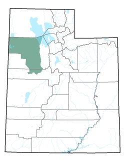
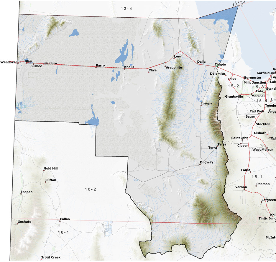
Policy area in green,
click on the map for more detail DESCRIPTION Covering most of the northern and central portions of Tooele County and a small part of Juab County from T3N to T12S, this area includes a large portion of the Great Salt Lake Desert and several relatively dry valleys. This area is bounded on the north by the Great Salt Lake and the northern part of the Great Salt Lake Desert, on the west by Fish Springs Flat, Tule Valley, Snake Valley and Nevada, on the east by the Stansbury and Onaqui Mountains, and on the south by the Sevier River drainage. The highest point in the area is 11,031 foot Deseret Peak, while the lowest is the shore of the Great Salt Lake at about 4,200 feet, giving a total relief of about 6,830 feet. |
|
|
|