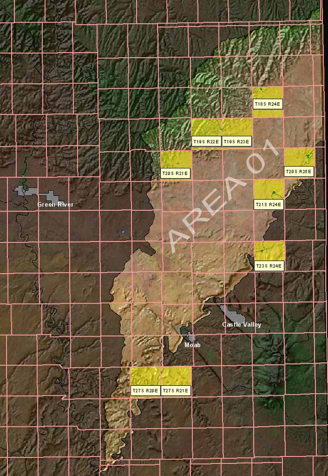
Click on the yellow highlighted townships on the map below to jump to PDF versions
of the Hydrographic Survey Sheets for Area 01.
These PDFs show digitized coverages based on May 1991 HSS sheets which were
georectified and placed atop USGS DOQ imagery.
Viewing the .PDFs requires that the Adobe
Acrobat Reader is installed on your computer. The
hydrographic
survey .PDF files average one megabyte each, please allow time for them to fully
download.