AREA 69 - WAH WAH VALLEY and SEVIER LAKE AREAUpdated:ĀApril 13, 2011 |
|
|
MANAGEMENT The Wah Wah Valley sub-basin has not been the subject of any court decrees of record, nor has the State Engineer adjudicated the small number of established water rights. There are no state-administered water distribution systems in this sub-basin. The Sevier Lake sub-basin is covered by the Sevier River Decree and the Sevier River Basin Water Rights Policy; it is also part of the Sevier River Distribution System administered by the Sevier River Commissioner and his deputies. Click here to see statistics for this area. SOURCES Surface Water - Surface waters
of the basin are generally considered to be fully appropriated. New surface
diversions and uses must be accomplished by change applications based on valid
existing water rights. Fixed-time projects involving surface waters must
be accomplished by temporary change applications on valid existing water rights,
which require annual renewal; this includes non-consumptive activities which
occur during the irrigation season. Applications for small surface water
appropriations of less than 2.0 acre-feet are considered, with approval dependent
upon the individual merits and circumstances of the application.
GROUNDWATER MANAGEMENT PLAN Effective November 5, 1997 the area is subject to the conditions of the Sevier River Basin Groundwater Policy. The policy was created to address issues raised after study of the basin hydrology and management alternatives. The major issue discussed was the close hydrologic connection between the surface water and ground water.GENERAL Applications are advertised in the Millard County Chronicle and the Beaver Press, depending on their location. The general irrigation diversion duty for this area, which the State Engineer uses for evaluation purposes, is 4.0 acre-feet per acre per year. The consumptive use requirement is determined from the publication Consumptive Use of Irrigated Crops in Utah, Research Report 145, Utah State University, 1994, unless the applicant submits other data for consideration. This area is administered by the Southwest Regional Office in Cedar City. Other Requirements The Water Right applicant is strongly cautioned that other permits may be required before any physical development of a project can begin and it is the responsibility of the applicant to determine the applicability of and acquisition of such permits. In order to avoid delays and ensure that Water Right approvals conform to applicable local ordinances, applicants should contact local governmental entities in advance to determine what ordinances are in place that affect the proposed project and to make sure that Water Right filings conform to those ordinances. The approval of a Water Right application does not imply any approval of a project by any other governmental entity. Approval of the project proposed in the Water Right application should be obtained from local governmental entities as necessary to implement a project. REFERENCES Technical Publication No. 19; An Appraisal of the Quality of Surface Water in the Sevier Lake Basin, Utah, 1964; Utah Department of Natural Resources; 1968. Technical Publication No. 47; Hydrologic Reconnaissance of the Wah Wah Valley Drainage Basin, Millard and Beaver Counties, Utah; Utah Department of Natural Resources; 1974. Technical Publication No. 96; Hydrologic Reconnaissance of the Sevier Lake Area, West-Central Utah; Utah Department of Natural Resources; 1991. Water-Resources
Investigative Report 95-4173, Simulated Effects of Proposed Ground-Water
Pumping in 17 Basins in East-Central and Southern Nevada; MODELING Regional Ground-Water Flow, Carbonate-Rock Province, Nevada, Utah, and Adjacent States; USGS Open-File Reports 93-170 and 93-420; 1993. PREVIOUS PAGE UPDATES None available. |
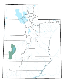
Policy area in green,
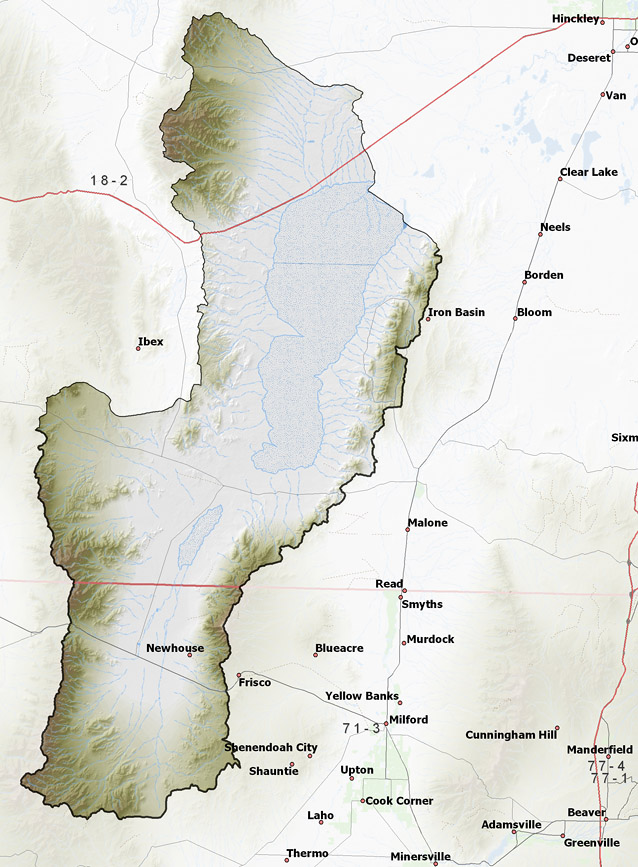
click on the map for more detail DESCRIPTION Stretching from south-central Millard County (T17S) into western Beaver County (T29S), this area is composed of two sub-basins, Wah Wah Valley and the area around Sevier Lake. The former covers about 600 square miles, while the latter covers about 850 square miles. The area includes several intermittent streams that flow from the surrounding mountains to the Wah Wah Valley Hardpan (a dry lake bed) or Sevier Lake. It is bounded on the east by the 9,660 foot San Francisco Mountains and the 7,231 foot Cricket Mountains. On the east are the 8,918 foot Wah Wah Mountains and the 9,655 foot House Range. A 6,000 foot pass at the southern end of the area separates Wah Wah Valley from the Escalante Desert, while the northern end opens into the Sevier Desert. A low saddle of about 4,700 feet divides Wah Wah Valley from Sevier Lake. The lowest point in Wah Wah Valley is the Wah Wah Valley Hardpan at 4,600 feet, while Sevier Lake is at an elevation of about 4,500 feet, giving the basin a total relief of about 5,160 feet.Click here to use the Water Rights GIS Map Server to view this area. |
|
|
|