AREA 29 - BEAR RIVER/BOX ELDER COUNTYUpdated:ĀJune 5, 2012 |
|
|
MANAGEMENT The area is part of the ongoing Bear River Adjudication. The first Proposed Determination of Water Rights book was published in 1990 for the Brigham City vicinity. A second book covering the Portage Creek watershed was published in 1991. No decrees have yet been issued. Several earlier decrees exist for a number of smaller streams. There are two state-administered distribution systems in this area: the Box Elder Creek/Big Creek Distribution System, which is currently inactive, and the Lower Bear River Distribution System. Because this area is part of the Bear River basin, the conditions of the 1955 Bear River Compact apply. Click here to see statistics for this area. SOURCES Surface and Ground Water - The area is open to appropriation of both surface and ground water, except in certain areas described hereafter:
GENERAL Applications are advertised in the Brigham City's Box Elder News-Journal or The Leader in Tremonton. Filings that may involve the diversion of water in Utah for use in Idaho (export) would be subject to the special criteria the statutes require for such projects. The general irrigation diversion duty for this area, which the State Engineer uses for evaluation purposes, is 4.0 acre-feet per acre per year. The consumptive use requirement is determined from the publication Consumptive Use of Irrigated Crops in Utah, Research Report 145, Utah State University, 1994, unless the applicant submits other data for consideration. This area is administered by the Northern Regional Office in Logan. Other requirements The Water Right applicant is strongly cautioned that other permits may be required before any physical development of a project can begin and it is the responsibility of the applicant to determine the applicability of and acquisition of such permits. In order to avoid delays and ensure that Water Right approvals conform to applicable local ordinances, applicants should contact local governmental entities in advance to determine what ordinances are in place that affect the proposed project and to make sure that Water Right filings conform to those ordinances. The approval of a Water Right application does not imply any approval of a project by any other governmental entity. Approval of the project proposed in the Water Right application should be obtained from local governmental entities as necessary to implement a project. REFERENCES Technical Publication No. 44, Ground-water Resources of the Lower Bear River Drainage Basin, Box Elder County, Utah; Utah Department of Natural Resources; 1974. Technical Publication No. 67, Seepage Study of the West Side and West Canals, Box Elder County, Utah; Utah Department of Natural Resources; 1980. Basic Data Report No. 1, Records and Water-Level Measurements of Selected Wells and Chemical Analysis of Ground-water, East Shore Area, Davis, Weber, and Box Elder Counties, Utah; Utah State Engineer; 1961. Basic Data Report No. 18, Quality of Surface Water in the Bear River Basin, Utah, Wyoming, and Idaho; Utah Department of Natural Resources; 1970. Basic Data Report No. 23, Selected Hydrologic Data, Lower Bear River Drainage Basin, Box Elder County, Utah; Utah Department of Natural Resources; 1973. Basic Data Report No. 45, Selected Hydrologic Data from Wells in the East Shore Area of the Great Salt Lake, Utah; Utah Department of Natural Resources; 1986. MODELING Regional Ground-Water Flow, Carbonate Rock Province, Nevada, Utah, and Adjacent States; USGS Open-File Reports 93-170 and 93-420; 1993. PREVIOUS PAGE UPDATES |
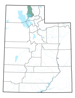
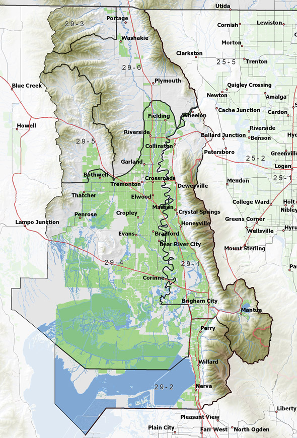
Policy area in green,
click on the map for more detail DESCRIPTION Comprising the eastern quarter of Box Elder County from T7N to T15N, this area covers the Bear River from Cutler Dam to the Great Salt Lake and the Malad River from the Idaho state line to its confluence with the Bear River. It is bordered on the north by Idaho, on the east by Clarkston Mountain and the Wellsville Mountains, on the south by the Great Salt Lake, and on the west by the West Hills. The highest point in the area is 8,244 foot Gunsight Peak, while the lowest is the surface of the Great Salt Lake at about 4,200 feet, giving a total relief of about 4,050 feet. |
|
|
|