AREA 92 - LOWER GREEN RIVERUpdated:�April 17, 2011 |
|
|
MANAGEMENT A Proposed Determination of Water Rights book (Lower Green River Division) was compiled and published in 1978. No pre-trial or final decree has been issued. There is no state-administered distribution system in this area. Because this area is part of the Colorado River basin, the conditions of the 1922 Colorado River Compact, the 1944 Mexican Treaty and the 1948 Upper Colorado River Compact and the State Engineer's Colorado River Policy apply. Applications to appropriate or change water are subject to conditions dealing with Green River Endangered Species Protection. Click here to see statistics for this area. SOURCES Surface and Ground Water - The water resources of this area are considered to be limited. New appropriations are limited to small amounts of beneficial use sufficient to serve the domestic requirements of one family, the irrigation of one acre, and ten head of livestock (or equivalent livestock units). New diversions and consumptive uses that require more water than this must be accomplished by filing a change application on valid existing water rights owned or acquired by the applicant. However, some water is available for larger appropriations on a Temporary (one-year) or Fixed Time period basis. Non-consumptive uses such as hydroelectric power generation would be considered on the individual merits of each application. All applications, including changes on existing water rights, are considered on their individual merits, with emphasis on their potential to interfere with existing rights and to ensure that there is no enlargement of the underlying rights. Applications are generally approved upon showing of an immediate need for water and with the presumptions that the applicant has all necessary resources and authorities to diligently develop the proposed beneficial uses of water and to file proof. Proof must be submitted by a registered land surveyor or engineer licensed in the State of Utah or a water user may file an election for proof to be completed by the State Engineer�s office. Requests for extensions of time in which to submit proof will be critically reviewed after the initial five-year period. GENERAL Applications are advertised in The Times-Independent in Moab or the Emery County Progress in Castle Dale or the Richfield Reaper in Richfield depending on the county where the source is located. At the discretion of the Regional Engineer an application may be advertised in more than one county, if he determines the application could affect the water rights located in bordering counties. The general irrigation diversion duty for this area, which the State Engineer uses for evaluation purposes, ranges from 4.0-6.0 acre-feet per acre per year. Click here to see a duty map for this area. The consumptive use requirement is determined from the publication Consumptive Use of Irrigated Crops in Utah, Research Report 145, Utah State University, 1994, unless the applicant submits other data for consideration. This area is administered by the Southeastern Regional Office in Price. Other Requirements The Water Right applicant is strongly cautioned that other permits may be required before any physical development of a project can begin and it is the responsibility of the applicant to determine the applicability of and acquisition of such permits. In order to avoid delays and ensure that Water Right approvals conform to applicable local ordinances, applicants should contact local governmental entities in advance to determine what ordinances are in place that affect the proposed project and to make sure that Water Right filings conform to those ordinances. The approval of a Water Right application does not imply any approval of a project by any other governmental entity. Approval of the project proposed in the Water Right application should be obtained from local governmental entities as necessary to implement a project. REFERENCES Technical Publication No. 15; Water from Bedrock in the Colorado Plateau of Utah; Utah State Engineer; 1966. MODELING None available. PREVIOUS PAGE UPDATES |
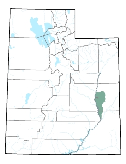
Policy area in green,
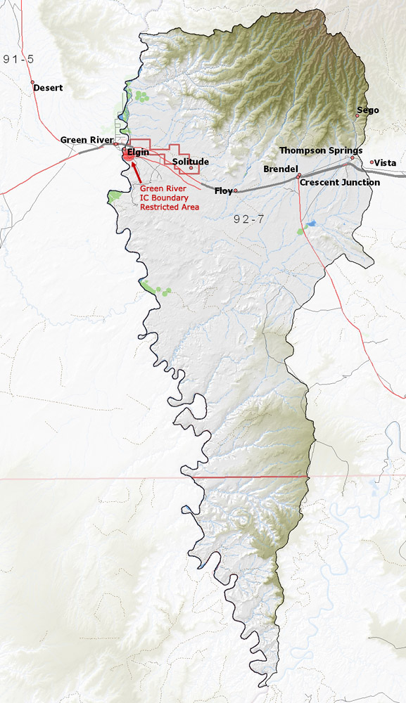
click on the map for more detail DESCRIPTION This area extends from northern Grand County in T16S, along the east side of the Green River to the northwestern corner of San Juan County in T30S and the confluence with the Colorado River. The major stream in this area is the Green River. This area is bordered on the north by the Uinta Basin, on the east by the Colorado River drainage, and on the west by the Green River. The highest point in the area is the 9,450 foot Nutter�s Peak in the Book Cliffs, while the lowest is at the confluence of the Colorado and Green Rivers at about 3,780 feet, giving a total relief of about 5,670 feet. |
|
|
|