AREA 31 - DAVIS COUNTYUpdated:ĀNovember 3, 2022Recent changes and additions in red text |
|
|
MANAGEMENT Five Proposed Determination of Water Rights books have been published. Four were published for the Southern Davis Division in 1966, and one for the Centerville Division on 1970. No final decrees have been issued. There are no state-administered distribution systems in this area. Click here to see statistics for this area. SOURCES Surface Water - Surface waters are generally considered to be fully appropriated.
New diversions and consumptive uses in these sources must be accomplished
by change applications filed on existing rights. Non-consumptive use applications,
such as hydroelectric power generation, will be considered on their individual
merits.
The following are excepted from the effect of this proclamation:
GROUNDWATER MANAGEMENT PLANS There are two groundwater management plans in place for Area 31 with the objective to guide future development, establish policy on new appropriations of water, protect the resource from over-utilization and preserve water quality:
GENERAL Applications are advertised in the Davis County Clipper. The general irrigation diversion duty for this area, which the State Engineer uses for evaluation purposes, is 4.0 acre-feet per acre per year. The consumptive use requirement is determined from the publication Consumptive Use of Irrigated Crops in Utah, Research Report 145, Utah State University, 1994. This area is administered by the Weber River Regional Office in Salt Lake City. Other requirements The Water Right applicant is strongly cautioned that other permits may be required before any physical development of a project can begin and it is the responsibility of the applicant to determine the applicability of and acquisition of such permits. In order to avoid delays and ensure that Water Right approvals conform to applicable local ordinances, applicants should contact local governmental entities in advance to determine what ordinances are in place that affect the proposed project and to make sure that Water Right filings conform to those ordinances. The approval of a Water Right application does not imply any approval of a project by any other governmental entity. Approval of the project proposed in the Water Right application should be obtained from local governmental entities as necessary to implement a project. REFERENCES Technical Publication No. 5, Ground Water in the East Shore Area, Utah: Part I, Bountiful District, Davis County; Utah State Engineer; 1948. Technical Publication No. 35, Ground-water Conditions in the East Shore Area, Box Elder, Davis, and Weber Counties, Utah, 1960-69; Utah Department of Natural Resources; 1972. Technical Publication No. 90, Seepage Studies of the Weber River and the Davis-Weber and Ogden Valley Canals, Davis and Weber Counties, Utah, 1985; Utah Department of Natural Resources; 1987. Technical Publication No. 93, Ground-Water Resources of the East Shore Area of the Great Salt Lake, Utah, and Simulated Effects of Ground-Water Withdrawals; Utah Department of Natural Resources; 1990. Technical Publication No. 95, Ground-Water Resources and Simulated Effects of withdrawals in the Bountiful Area, Utah; Utah Department of Natural Resources; 1991. Basic Data Report No. 1, Records and Water-Level Measurements of Selected Wells and Chemical Analyses of Ground Water, East Shores Areas, Weber and Box Elder Counties, Utah; Utah State Engineer; 1961. Basic Data Report No. 45, Selected Hydrologic Data from Wells in the East Shore Area of the Great Salt Lake, Utah, 1985; Utah Department of Natural Resources; 1986. Information Bulletin No. 8, Projected 1975 Municipal Water Use Requirements, Davis County, Utah; Utah State Engineer; 1962. USGS Scientific Investigations Report 2014-5213, Steady-State Numerical Groundwater Flow Model of the Great Basin Carbonate and Alluvial Aquifer System; 2014. USGS Scientific Investigations Report 2017-5072, Groundwater Model of the Great Basin Carbonate and Alluvial Aquifer System Version 3.0: Incorporating Revisions in Southwestern Utah and East Central Nevada; 2017. MODELING Regional Ground-Water Flow, Carbonate-Rock Province, Nevada, Utah, and Adjacent States; USGS Open-File Reports 93-170 and 93-420; 1993. Weber Delta Ground-water Flow Model, 1990. Bountiful Area Ground-water Flow Model, 1992. PREVIOUS PAGE UPDATES |
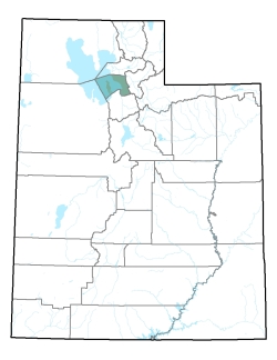
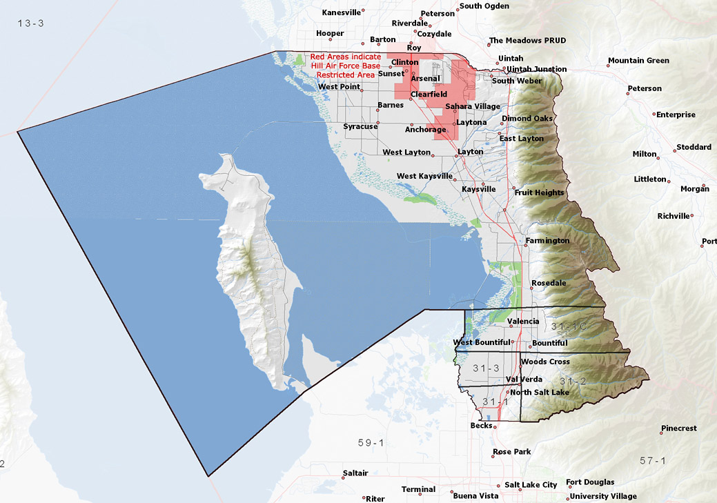
Policy area in green,
click on the map for more detail DESCRIPTION Covering all of Davis County, this area includes the surface sources draining from the Wasatch Range, on the eastern boundary, westward to the Great Salt Lake. Major streams include Mill Creek, Holbrook Canyon, Davis Creek, Shepard Creek, Baer Creek, and Kays Creek. This area is bounded on the north by the Weber Delta in Weber County, on the east by the East Canyon Creek drainage, on the south by the Jordan River Valley, and on the west by the Great Salt Lake. The highest point in the area is a 9,706 foot unnamed peak at the head of the South Fork of Kays Creek, while the lowest is the Great Salt Lake at about 4,200 feet, giving a total relief of about 5,500 feet. Much of this area is served by public water suppliers for both potable and secondary water. |
|
|
|